


Chalance :

ARPF1
User

Length
9.2 km

Max alt
2525 m

Uphill gradient
1117 m
Km-Effort
24 km

Min alt
1395 m

Downhill gradient
1112 m
Boucle
Yes
Creation date :
2020-02-22 13:36:37.419
Updated on :
2020-02-22 13:37:27.643
5h00
Difficulty : Difficult

FREE GPS app for hiking
 SityTrail
IGN / Geographical institutes
SityTrail Plus
The world is yours!
About
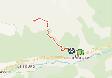
Trail On foot of 9.2 km to be discovered at Provence-Alpes-Côte d'Azur, Hautes-Alpes, La Chapelle-en-Valgaudémar. This trail is proposed by ARPF1.
Positioning
Country:
France
Region :
Provence-Alpes-Côte d'Azur
Department/Province :
Hautes-Alpes
Municipality :
La Chapelle-en-Valgaudémar
Location:
Unknown
Start:(Dec)
Start:(UTM)
283453 ; 4967291 (32T) N.
Comments